The Mediterranean arch of the E12 long distance path in
Slovenia was opened on December
10th, 2016. The path's custodians are the Coastal Alpine Club Koper and
the Slovenian
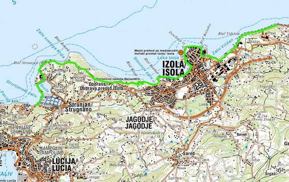
Commission for the European pathways.
1. The Slovenian segment of the path starts at the meeting
point with the Italian segment on
The Route of Health and Friendship (Parenzana) near the former border
crossing of Škofije. It
continues to Škofije and then follows the Slovenian mountain hiking trail
all the way to Hrvatini
and downwards to Ankaran.
2. The path then follows the road to Koper over the area of
Ankaran Bonifika, to the viaduct and
over the railway, continues on the walking trail and pavements passing the
Škocjanski zatok
nature reserve all the way to the Porsche building.
3. It then passes the entrance of Port of Koper to the
northern bypass, on Pristaniška cesta and
Semedela Promenade to The Route of Health and Friendship at Semedela
highway underpass.
4. It passes Žusterna, goes towards Izola, to the roundabout,
right to Cankarjev drevored, to
Tovarniška ulica and Ulica ob pečini to Izola north beach, then on
Kopališka ulica to Izola Veliki
trg and Sončno nabrežje all the way to Lonka.
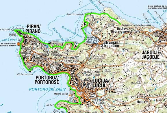
5. The path continues through the Izola Marina to Simonov
zaliv and follows the coastal walking
trail to Belvedere. Here it joins the E6 long distance path (the Ciglar's
trail). E6 and E12 follow
the cart track which descends from Belvedere area towards Ronek peninsula. The
track then
continues to the trail above the cliff of Mesečev zaliv to Krka Hotel.
6. From here E6 and E12 run together pass Lambada restaurant
and then on the trail on the edge
of Sečovlje Salina Nature Park to Salinera Hotel. On the curve above the
hotel complex
the two paths direct horizontally to the trail to Pacug and downwards to Fiesa.
7. From here the path climbs to Piran church, then descends to
Punta and continues along the
coast to Tartini Square and on to Fornače, Bernardin and through Portorož
to Lucija campsit.
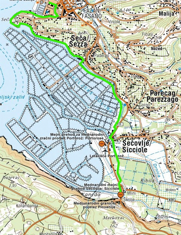
8. It then continues on The Route of Health and Friendship around Seča peninsula
and below
Forma Viva. It follows Jernej Channel to Seča and then on the edge of
Sečovlje Salina Nature
Park to Sečovlje. At Sečovlje border crossing the joined path enters
Croatia.
The path is around 50 kilometres long and has 3 control points
with seals (one in Ankaran's
Korta bar, one in Strunjan's Talaso Hotel and one in Sečovlje at the info
point of Museum of Salt
making). It takes us 2 to 3 days to walk the entire path.
The E12 starts in Spain, continues to France, Italy, then
follows the Slovenian and Croatian
coastline all the way to Montenegro, Greeceand eastern Mediterranean.
The Slovenian segments of European footpaths are marked by red and yellow signs.
KEUPS President,
Jože Prah


For Google map click here (Use at you own risk!)
Share with your friends: